A place in the story
Wli Waterfalls
A Volta Region waterfall reached through village and forest landscapes near Ghana's border with Togo.
Narration available · 2 min
Listen to the story
Wli Waterfalls, narrated.
Read transcript
A Volta Region waterfall reached through village and forest landscapes near Ghana's border with Togo.
The road into the forest. Wli is not a waterfall that appears without a journey. The route passes through villages, farms and forest before the sound of falling water starts to compete with conversation. That approach matters because the attraction is part of a lived landscape. Guides, residents and local services shape the visit long before anyone reaches the pool. The lower falls is the more accessible experience, while the upper falls asks for more time, fitness and attention to the trail.
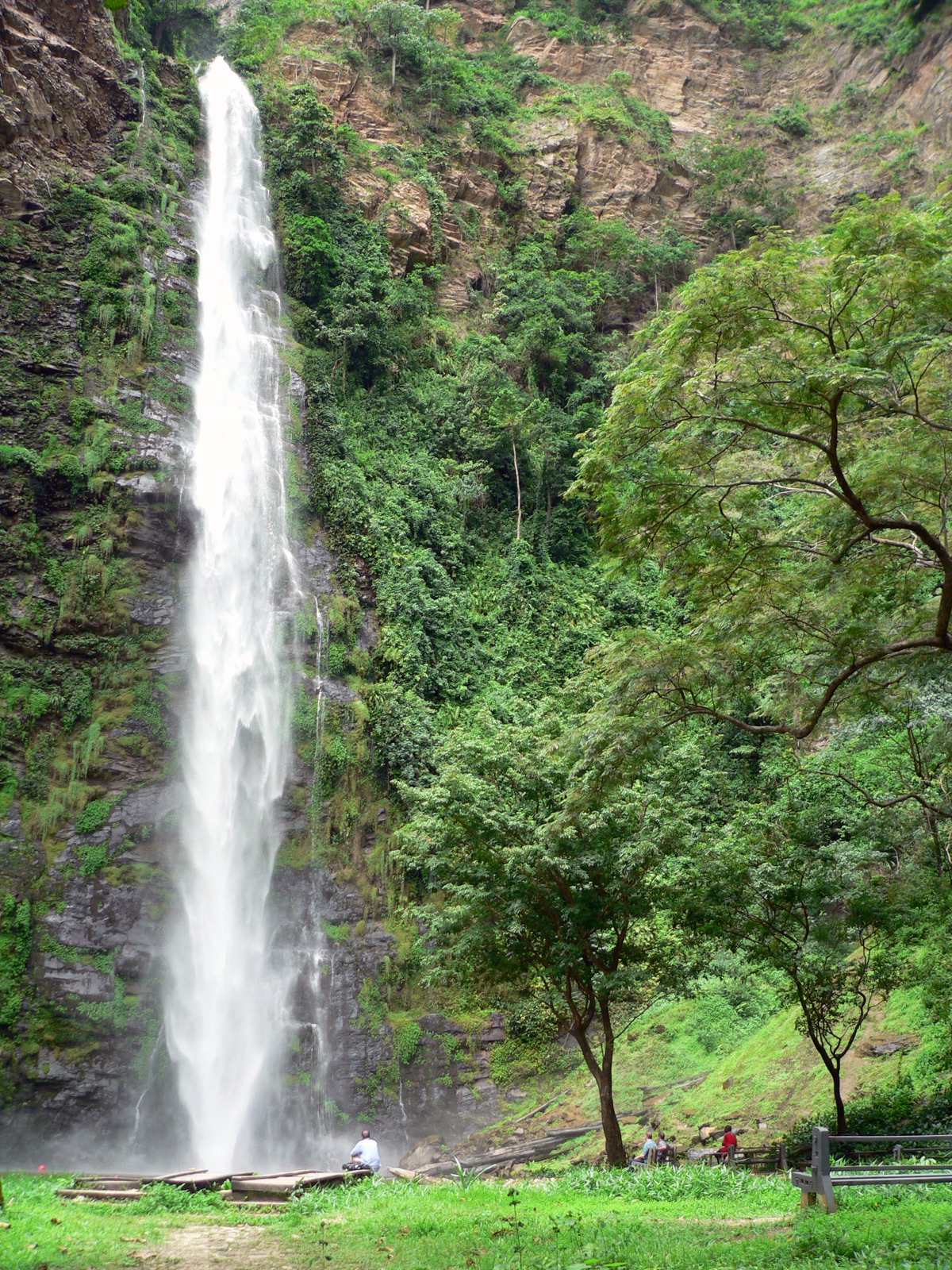
Water at two scales. The lower falls can feel immediate: water drops through green forest and gathers in a pool where visitors finally understand the scale of the place. The harder upper route changes the story again, leading toward a wider view near the Togo border. Rainfall changes the force of the water, so the same landmark does not look identical throughout the year. That variation is part of the geography, not a failure of the attraction.
A shared landscape. Wli rewards visitors who make room for the people who keep the route open. Use a local guide, carry water and wear shoes that can handle wet or uneven ground. Do not treat the village as a backdrop on the way to the falls. The place sits inside the Volta Region's wider story of borders, forests, farming and movement. The walk is the lesson: a memorable destination depends on the landscape and community around it, not only on the final view. Read this place alongside the people who maintain it. A landmark becomes useful when it changes what you notice next: the road into a town, the work around a museum, the river beyond a view, or the memory a guide chooses to explain.
Wli links a dramatic natural feature to village life, forest access and the geography of Ghana's eastern borderlands.
The road into the forest
Wli is not a waterfall that appears without a journey. The route passes through villages, farms and forest before the sound of falling water starts to compete with conversation. That approach matters because the attraction is part of a lived landscape. Guides, residents and local services shape the visit long before anyone reaches the pool. The lower falls is the more accessible experience, while the upper falls asks for more time, fitness and attention to the trail.
Water at two scales
The lower falls can feel immediate: water drops through green forest and gathers in a pool where visitors finally understand the scale of the place. The harder upper route changes the story again, leading toward a wider view near the Togo border. Rainfall changes the force of the water, so the same landmark does not look identical throughout the year. That variation is part of the geography, not a failure of the attraction.
A shared landscape
Wli rewards visitors who make room for the people who keep the route open. Use a local guide, carry water and wear shoes that can handle wet or uneven ground. Do not treat the village as a backdrop on the way to the falls. The place sits inside the Volta Region's wider story of borders, forests, farming and movement. The walk is the lesson: a memorable destination depends on the landscape and community around it, not only on the final view. Read this place alongside the people who maintain it. A landmark becomes useful when it changes what you notice next: the road into a town, the work around a museum, the river beyond a view, or the memory a guide chooses to explain.
Why this place matters
Wli links a dramatic natural feature to village life, forest access and the geography of Ghana's eastern borderlands.
Visiting with care: The lower and upper routes have different demands. Start early, use local guidance and check trail and water conditions.
Where this is today
Wli Waterfalls
Volta Region · Exact surviving site
Open modern mapSources
Read the references behind this story.
Image credit: Stig Nygaard via Wikimedia Commons · Image source
 Continue to Kejetia MarketKejetia MarketKumasi's enormous market is not just a shopping stop. It is a working map of movement, trade, food and everyday Ashanti life.